History of Lake Palestine
Lake Palestine Location and Size
Lake Palestine is located about 15 miles southwest of Tyler, Texas, on Texas Highway 155, the result of a dam on the Neches River owned and operated by the Upper Neches River Municipal Water Authority.
Portions of Anderson, Cherokee, Henderson, and Smith Counties are included in the lake. The Neches River continues flowing southward from the dam, establishing the boundary between Anderson and Cherokee Counties. The channel of the Neches River through Lake Palestine marks the boundary between Henderson County and Smith County.
Lake Palestine has a surface area of 25,560 acres (40 square miles) and a maximum depth of 50 feet, and an average depth of 16 feet.
The lake is 18 miles long, stretching basically north to south, from Chander to near Frankston, with 135 miles of shoreline. The widest part of the lake is 4 miles across.
The crest of the spillway is 345 feet above mean sea level, and the conservation storage capacity is 411,290 acre-feet with a surface area of 25,560 acres. The drainage area above the dam is about 839 square miles. The maximum typical fluctuation is 2.2 feet.
History of Lake Palestine
The Neches River rises just east of Colfax in eastern Van Zandt County and flows southeast for 416 miles to its mouth on Sabine Lake, on the northeastern edge of Port Arthur. The Neches has a drainage area of 10,011 square miles.
During the Civil War, there were no bridges which crossed the Neches River. The use of ferries was the only effective means to cross the river, at Blackburn’s Crossing, Cannon’s Ferry and Stemson’s Perry.
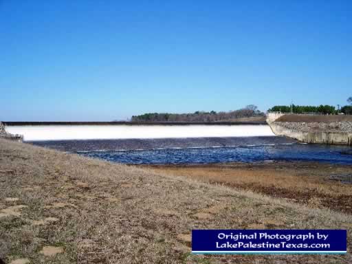
Construction of the original dam was begun in 1960, and completed in 1962. An enlargement project was begun in 1969 and completed in 1972. Today, Lake Palestine is formed by the earthfilled Blackburn Crossing Dam, and is used for water conservation, recreation, and wildlife preservation. The dam is 75 feet high, and has a length of 5,720 feet.
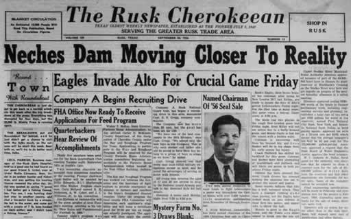
| Headline in the Rusk Cherokeean September 20, 1956 "Neches Dam Moving Closer to Reality" |
 |
| Shown below is a photo of Blackburn Crossing Dam on Lake Palestine |
 |
|
